Images from satellites and drones could support civilian rescue organisations in operations in the Mediterranean, and an app could help against pushbacks at land borders. But the technology is currently only helping in rudimentary ways at best.
The Mediterranean Sea is considered one of the best-monitored seas in the world, yet its coastal states continue to let thousands of people drown there. With various initiatives, activists want to make use of new observation technologies and use the data thus obtained to monitor the state perpetrators. The concept is not new. At the end of the last century, the term “sousveillance” was established for it. However, the increasing free availability of data today is not comparable to the situation in the 1990s – the origin of the “sousveillance” movement. In the meantime, satellite images and position data from ships can contribute to the subsequent clarification of human rights violations in the Mediterranean and the prosecution of those responsible.
The German association Space-Eye, for example, is experimenting with satellite data. The dozen or so scientists and students use images from the EU’s Copernicus Earth observation programme. These satellite services generate images with low resolution and short temporal coverage. For effective observation, the association would therefore have to buy additional, expensive images from satellite services. This is another reason why the project is currently in a scientific stage, for which Space-Eye is working with various universities and colleges.
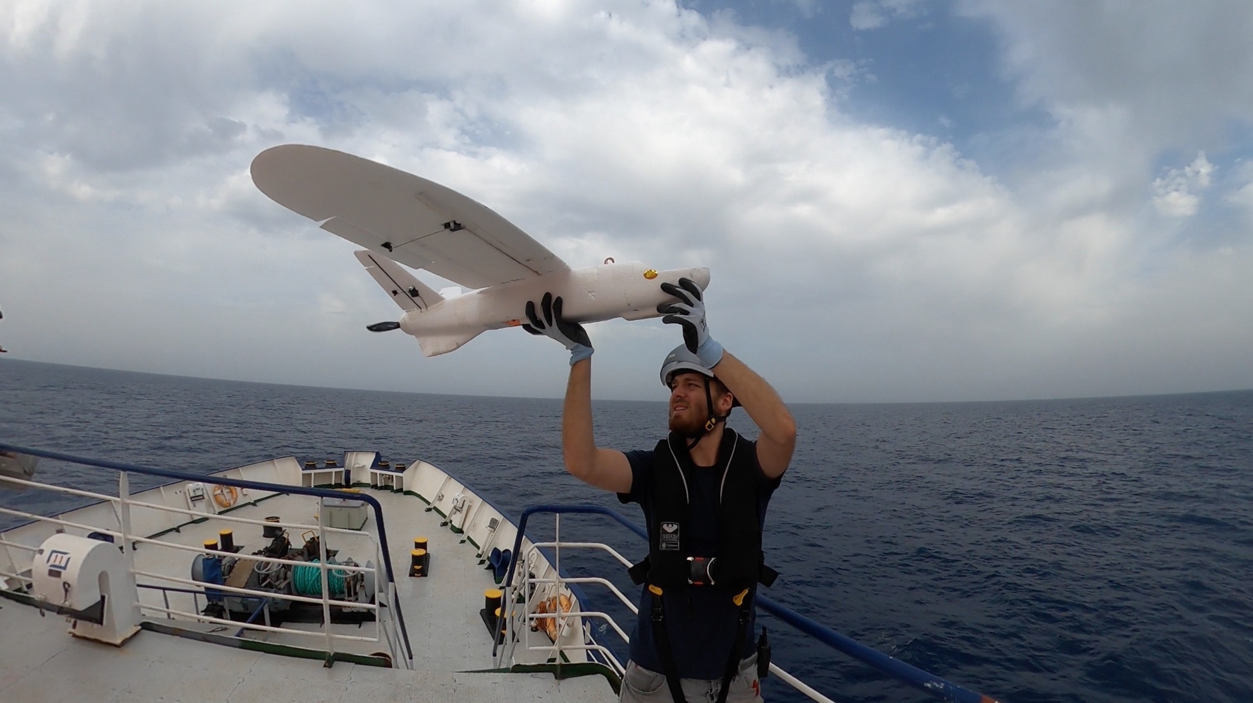
Another approach with its own monitoring device is being pursued by the Searchwing association, which has developed a low-cost, waterproof drone with the Augsburg University of Applied Sciences. It can be hand-launched on a ship and scan the surroundings for boats in distress. In a mission lasting up to two hours, the fixed-wing aircraft can fly up to 120 kilometres. The technology has already been tested several times on civilian rescue ships in the Mediterranean. However, the capabilities are limited by the payload, which so far only allows a payload of cameras with a not too high resolution. A search at night is also not yet possible. In addition, the drone has to land in the water and be recovered there. The biggest shortcoming, however, is probably the lack of real-time transmission of the recorded images.
Finally, activists of the Leave No One Behind platform in Germany are experimenting with the use of location data to prevent or at least document so-called pushbacks. For this purpose, they are programming an app called “Claim Asylum EU”, which is supposed to support people in the asylum procedure. The target group includes protection seekers who, as in Greece or Poland, are pushed back by the border authorities there without being able to apply for asylum as stipulated in international conventions. With the app, those affected should be able to apply for asylum electronically immediately after reaching an EU member state and log their location with GPS data. In addition, users can take pictures of themselves and their surroundings, which can be stored in a cloud with time and location stamps.
It is clear from the examples that the reversal of the new observation technologies is at best rudimentary at present. This inequality of arms could change only if the watchers were to share their data. Civil organisations have been demanding for years that the EU border agency Frontex also make the footage of its aircraft and drones available for sea rescue; the same could apply to satellite data that Frontex buys from commercial providers. This would not change the fundamentally wrong EU migration policy, but fewer people would have to drown in the Mediterranean.
Published in German in „nd“.
Image: Searchwing.


Leave a Reply