Searchwing has developed a waterproof drone that can be hand-launched from a ship. In a two-hour mission, the aircraft flies up to 120 kilometres. For real-time transmission, members are working on a new model.
In the Mediterranean, EU agencies use drones to track and stop refugees on their way to Europe. Since May this year, Frontex has stationed an Israeli “Heron 1” on Malta, soon to be followed by an even larger drone. Individual member states are also increasingly relying on autonomous systems for their coast guards. They are supported in this by EMSA, the Maritime Safety Agency.
For some years now, non-governmental organisations have also been experimenting with unmanned aerial vehicles. Their objective is to rescue people on the high seas and then disembark them in a state that will not persecute or mistreat them. One of the groups is Searchwing. In October, the activists completed a test on the ship “Sea-Watch 4”. I spoke to Philipp Borgers about this.
netzpolitik.org: Once again, you have tested your drones in a real, harsh environment in the Mediterranean. What kind of aircraft are they, how are they launched and landed?
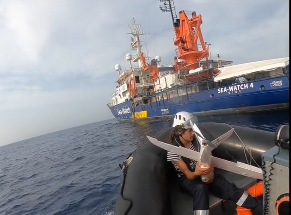
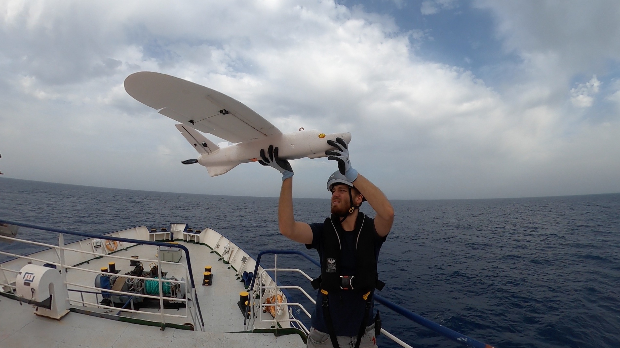
Searchwing: We took two drones on the five-day crossing of the “Sea-Watch 4” to Burriana in Spain. These are so-called “Fixed Wing UAV’s” [Unmanned Air Vehicles], they have wings and look like a small plane. The drones have a wingspan of 130 centimetres, a length of 83 centimetres, weigh about two kilograms and are pushed into the air by an electric motor. The take-off takes place from the ship, in the case of the “Sea-Watch 4” from the “captain’s balcony”. The drone is launched by a co-pilot by throwing it.
This means that the drones are fished out of the water with an inflatable boat after each flight?

The drones are recovered from the water with the so-called RHIBs, the dinghies used for rescue. A rescue takes about ten minutes after landing near the mother ship.
What is the maximum duration of such an operation?
With our latest lithium-ion batteries, we can fly about 120 kilometres. At a speed of 60 km/h, a mission lasts two hours. We can reach speeds of up to 100 km/h.
Compared to drones of previous generations, that’s quite a figure. When you use several aircraft, how large is the area covered by the observation? And how high do they fly?
The drones are supposed to fly at an altitude of 550 metres. However, this also depends on the weather and the deployment scenario. One drone can cover about 100 square kilometres with its two cameras. The simultaneous use of several aircraft is conceivable, but not yet planned, as this would probably overwhelm the users at first. The pilots, who will be recruited from the crew of the rescue ships, will be prepared for their mission in a two-day training course.
What sensors do you have on board for this?

We have two Raspberry Pi Cameras V2.0 on board, which are basically standard hardware from smartphones and have a resolution of 3280 x 2464 pixels. This gives us a theoretical ground resolution of 20-30 centimetres per pixel at the altitude we are aiming for, allowing us to achieve a two-kilometre-wide search strip along the direction of flight. In the long term, higher resolution cameras are planned. In addition, we are currently testing sensors to be able to conduct a night search. A hot candidate is the FLIR Lepton 3.0 thermal imaging camera, which, despite its low resolution, makes it possible to find groups of people or running engines in the open sea. Furthermore, low-light cameras could be interesting, which are cheap, have high resolutions and could still provide usable images even in moonlight.
Can you describe the ground station in more detail? How is the drone controlled, how is the data received?
The drone flies automatically. This means that we can intervene in the flight process at any time, but we programme it before take-off. We use QGroundControl, a free software, for planning and displaying the telemetry. We receive the telemetry via 868-MHz radios, which we have tested over distances of up to 50 kilometres. At a distance of two kilometres, we can control the drone using a normal radio remote control. The image data is currently downloaded via WLAN after the flight. A “live” transmission is in the works.
What challenges does that mean? The payload will increase significantly, can your current flying machines manage that?

The current hull is relatively small and limits us.For another sensor and/or a “live” transmission, a larger waterproof 3D-printed box would then have to be designed. This may then need to be built into a larger hull. However, a transfer of the concept is conceivable and also planned. The payload does not increase noticeably with new components. At the same time, we are experimenting with fibre composites and our own design for a fuselage at Augsburg University.
You are based at Augsburg University of Applied Sciences. Is there a reason for that?
Our project consists of two larger teams, which are mainly distributed between Berlin and Augsburg. In Augsburg, mainly students and scientists are working on the project in the areas of drone manufacturing. In Berlin, a larger group is working on the algorithms that support users in evaluating the real image data, but also on projects such as broadband data transmission between the drone and the ground station.
When did you start the project, was there a particular trigger?
Augsburg University of Applied Sciences took up the topic after Professor Dr.-Ing. Friedrich Beckman, Fritz for short, had seen a presentation by SearchWinglers at the Chaos Communication Congress of the Chaos Computer Club describing the unbelievable conditions in the Mediterranean. Looking back, somewhat naively, the lecturers explained that with a little technology and a few “nerd skills” it would be possible to save people’s lives. Fritz got his department to support the project and has been one of the shoulders on which the project stands ever since. Currently, there is also the possibility to do an applied master’s degree at Augsburg University of Applied Sciences in the SearchWing project.
Do you know of any other projects in which drones are to be made usable for sea rescue? I don’t mean the EU agencies Frontex or EMSA, which conduct unmanned reconnaissance in the Mediterranean but then bring the refugees they have tracked down back to North Africa?
There are or were certainly some projects to use drones in sea rescue, but probably few in the central Mediterranean. It is difficult to assess how many of these are currently still being pursued, as information is not regularly published. We only know of a group of students in Spain who were still working on a multicopter drone.
Frontex, for example, has completely different financial resources, so it is actually up to them to use existing technologies such as droppable life rafts also on their aircraft and to use the information obtained from the air for a European sea rescue mission.
Image: Flight tests at different altitudes on the “Sea-Watch 4” in the Mediterranean (Searchwing, CC-BY-NC 3.0),


Leave a Reply