This year, the EU is again conducting drone flights for many Member States. Due to many unfulfilled requests, unmanned capabilities are now being expanded. Two drones from Austria and Portugal have become established for coastguard missions. One of the manufacturers has now received a Europe-wide certificate for the first time.
The European Maritime Safety Agency (EMSA) has presented its plans for unmanned flights over European seas this year. According to the report, 14 European governments want to use EMSA drones for coastguard tasks, tracking pollution or inspecting port facilities. This is stated in the EU Commission’s answer to a written question by MEP Özlem Demirel.
EMSA has become the European Union’s drone agency after initial tests in 2017. Missions were first carried out for the coast guard of Iceland. Subsequently, Bulgaria, Greece, Lithuania, the Netherlands, Portugal, Spain and France, as well as the EU Fisheries Agency, have ordered the services with different types of drones. The duration of the respective missions is usually three months. Soon, Frontex will also have large drones at its disposal; until then, the EU border agency uses EMSA unmanned aerial vehicles.
Deployment in Germany cancelled

EMSA drones will again fly for the coast guard in France, Italy, Spain and the Netherlands in 2021, as well as in Denmark, Sweden, Finland and Estonia. “Interest” also came from Bulgaria and Greece. Whether these flights can be carried out is still unclear due to a lack of capacity. EMSA is therefore continuing to expand its drone fleet. Recently, the agency published another EU tender for 20 million euros for this purpose. In total, EMSA has spent over 200 million euros on flights with unmanned aerial vehicles since 2017.
The German Federal Maritime and Hydrographic Agency (BSH) had also requested drone flights from EMSA, which should have taken place last year. However, the authority did not want to use them to support the coast guard, but to monitor emissions from ships in the North and Baltic Seas. But due to the ongoing Corona pandemic, no missions have been carried out so far. This was recently announced by the Federal Office in response to a freedom of information request. The BSH does not yet know whether the flights will be rescheduled.

Two unmanned aerial vehicles have now been selected by EMSA for maritime surveillance. Either the agency uses the fixed-wing aircraft “AR-5” from the Portuguese company Tekever or the vertical take-off “Camcopter” from the company Schiebel in Austria. Both weigh well over 100 kilograms and carry around 50 kilograms of payload. For maritime surveillance, the drones are primarily equipped with optical and daylight-independent cameras; the “AR-5”, which can be controlled via satellite communication, also carries a maritime radar, a receiver for data on ship positions and an antenna for so-called radio beacons for marking a distress position at sea.
Schiebel may authorise flights itself
Three weeks ago, Schiebel GmbH received the EU’s first “Light UAS Operator Certificate” (LUC). The operator certificate issued by the national air traffic control allows the company’s drone pilots to authorise flights of the “Camcopter” in civil airspace themselves. Until now, their operators had to apply the authorities for daily operations.
The LUC certificate is part of the EU Drone Regulation, which came into force at the end of 2020. It is open-ended and is intended to enable manufacturers of unmanned aerial vehicles to carry out new applications throughout the European Union. Schiebel expects the LUC to “multiply” the possible applications of the “Camcopter” in the civilian sector. This year, the company says it is active in eight European countries. Services for EMSA will now also be carried out under the LUC.
This year’s EMSA drone flights also involve French satellite service provider CLS, which specialises in maritime surveillance in the EU’s “I-REACT” project. In 2019, CLS and the drone manufacturer Tekever presented a “big data platform” that uses artificial intelligence to combine data from various sources. This includes weather forecasts and climate models, which are common in the maritime sector, but also a platform for analysing Twitter. Information from EU satellites within the framework of the “Copernicus” project will also be integrated.
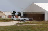
Image: Flights with the large helicopter drone may now be authorised by its manufacturer throughout Europe. This expands the range of applications enormously (Schiebel).


Leave a Reply