High-flying drones are to reconnoitre the EU’s external borders from the stratosphere, a static zeppelin is already observing close to the ground. With interception systems in space, the EU border agency wants to locate and possibly tap satellite telephones in the Mediterranean. So far, the technology has only been installed in aircraft.
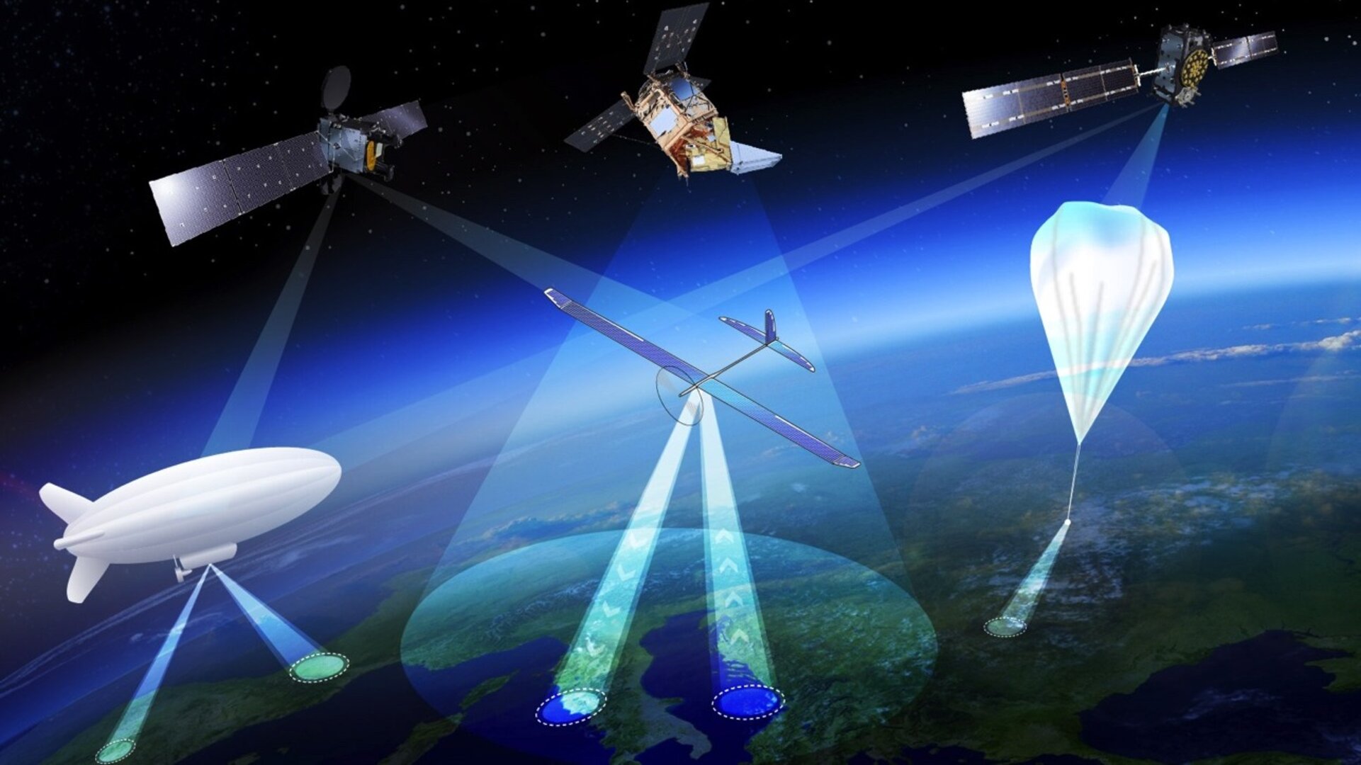
The European Union‘s border agency Frontex is expanding its “surveillance capability” with high-flying platforms. In a call for tenders, systems are being sought for use in the stratosphere. At an altitude of 20 kilometres, they are to close the gap between the aircraft, drones and satellites already in use.
The systems sought include so-called high-altitude platforms (HAPS) or lighter-than-air (LTA) solutions, such as those currently being developed to series maturity by the European armament company Airbus with the glider “Zephyr” or its French competitor Thales with the zeppelin-like “Stratobus”, which can last for months or even years. Suppliers of microsatellites, which can be launched into space extremely cheaply these days, can also apply.
The launch of HAPS has been driven by the EU Space Agency since 2017, and its market share at the time was estimated to be over €7 billion by 2024. Frontex could therefore be one of the first users of the new technology, as with the “Space Data Highway”.
Planes, drones and zeppelins in constant use
Frontex is responsible, among other things, for monitoring the EU’s external borders. The original goal of the agency, which was founded in 2005, was to coordinate the border and coast guards from the member states in “joint operations”. Since 2016, Frontex has been allowed to procure its own equipment; corresponding funds were initially used to set up its own air surveillance.
2017, Frontex started a fleet of private charter planes flying over numerous land and sea borders of the European Union. The current two-year contract for the small twin-engine aircraft of this “Frontex Aerial Surveillance Service” (FASS) is worth 101.5 million Euros.

In May this year, Frontex added high-flying drones to its aircraft fleet. They can fly up to four times longer than manned planes. Currently, Airbus is stationing on behalf of Frontex a “Heron 1” from Israel Aerospace Industries in Malta. After six months, it is supposed to be followed by a “Hermes 900” from Elbit, also from Israel. For operations close to the ground, Frontex is also looking for companies that offer smaller quadrocopters and provide training on how to control them.
Since this year, Frontex has also been using a so-called aerostat on the Greek-Turkish border river Evros and over the island of Limnos. This airship is attached to a tether several hundred metres long. It can remain in the air for up to 40 days and carry a payload of around 200 kilograms. At sea, its surveillance radius is up to 60 kilometres. Frontex initially tested the tethered zeppelin before in a pilot project with the Greek coast guard off the island of Samos.
More satellite surveillance

With the establishment of the surveillance network EUROSUR, Frontex has been permanently monitoring the EU’s external borders with optical and radar-based satellites since 2014. The Frontex headquarters in Warsaw uses the EU satellite programme “Copernicus” for this purpose, which also provides data on environmental and climate change. In various research programmes, Frontex has built up various services for border authorities on the basis of the EU satellites, including the tracking of suspicious ships, the automatic detection of small boats or the observation of refugee camps.
In its “EUROSUR Fusion Centre”, Frontex brings together all the data from aerial surveillance. There, it is enriched and evaluated with information from other geo-information and ship reporting systems or ship databases. Frontex has procured such an artificial intelligence-based analysis platform from the Israeli company Windward, which also counts intelligence services and the military among its customers.
Surveillance from space will now be extended to high-frequency radio signals. Frontex is awarding 5 million Euros to an unknown company that will track radar, radio communications or satellite phones from space. With this reconnaissance, known as COMINT (“Communication Intelligence”), Frontex wants to identify ships that switch off their transponders and can therefore no longer be located. Boats with refugees could also be located in this way, as long as the people inside carry appropriate telephones for emergencies at sea.
The contract could have been awarded to the company HawkEye360, which offers exactly the required services and has already signed a corresponding deal with Frontex in 2019 after a pilot project from two years before. The company launched the required microsatellites into space in 2018 with a “SpaceX” of space tycoon Elon Musk.
Eavesdropping technology with Frontex planes?
It is unclear to what extent Frontex not only locates satellite telephony but also intercepts it. According to the British company Horizon Technologies, the EU border agency is (with NATO) one of the customers for its “FlyingFish” platform, which is also based on microsatellites and can record telephone calls from providers such as Thuraya, Iridium and Inmarsat. According to the company, a NATO member state ordered its SIGINT (“Signal Intelligence”) technology for surveillance in the Mediterranean as early as 2017, possibly referring to France, which is said to have equipped a military aircraft with “FlyingFish”.

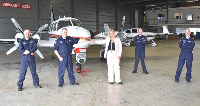
Such equipment is also reportedly installed on aircraft chartered by Frontex. This is confirmed by a report from the Dutch airport Den Helder, according to which platforms based on “FlyingFish” are in use for other EU agencies.
Under the name “Xtender”, the company has meanwhile miniaturised the system to around 5 kilograms, so that it can also be carried by small drones. According to Frontex, however, the “Heron 1” currently stationed in Malta is not equipped with such technology.
The London-based civil liberties organisation Privacy International wanted to know details of the new interception technology and its forms of use from Frontex. The border agency refused to provide the information on the grounds that it would “benefit criminal networks”. According to its own information, Frontex passes on the coordinates of boats with refugees to the Libyan “coast guard”, after which the people are returned to torture camps there. However, it remains unclear whether Libyan authorities are also allowed to use raw data from Frontex surveillance or analyses made from it.
Image: ESA.


Leave a Reply